Lahaul and Spiti
General Info
· Lahaul
· Baralacha Range
· Chandra Valley
· Bhaga Valley
· Keylong
· Chandra-Bhaga Valley
· Great Mountain Mass
· Lingti Plains
· Spiti
· Climate
· Kaza
· Pin Valley
Other Places of Interest
Passes
· Baralacha Pass
Rivers
· Chandra River
· Chandra - Bhaga
· Spiti River
Glaciers
Lakes
Chandratal Lake
Suraj Tal Lake
People
· Lahaulas
· Tradition & culture
· Spiti
Religion
Fairs and Festivals
History
· Lahaul
· Spiti
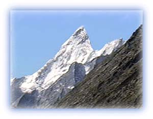
Visual Delights

![]()
Nearly 28 km long and several kilometers wide at its widest, the Bara Shigri is the largest glacier of the Lahaul Valley of Himachal Pradesh. It opens out onto the Chandra Valley and adds its waters to the river. It is located in a cirque on the middle slopes of the main Himalayan range. Small tributary glaciers feed the main glacier. The entire tract is devoid of a vegetative cover. High mountains surround this glacier on three sides. All around are the great peaks of the Parvati headwaters -- White Sail, Indrasan and, further up the range, Kulu Makalu and the Parbati peak itself. |
 |
| The lovely Chandratal Lake Credit: Karamjeet Singh |
Lakes
Chandra Tal Lake
This is a beautiful glacial lake located at the source of the
Chandra River in the Lahaul Valley of Himachal Pradesh. The
towering main Himalaya hems the northern periphery of the
Chandratal lake. This lake is fed by melt-waters from the
Chandra glacier. The lake is situated at an altitude of 15,500
ft above sea level.
 |
| Mulkilla and the Samundra Tapu glacier Credit: Karamjeet Singh |
The Chandra Tal lake lies in a large depression formed by the glacier. The Chandra Tal -- "the lake of the moon" -- is an apt name as it lies in a broad turquoise crescent along the flank of the Great Himalayan range. It is surrounded by the high peaks of the Chandrabhaga and Mulkila massifs.
The Chandra Tal is a glacial lake. It was probably formed at the end of the last ice age. When the glaciers retreated, they left behind large "dead" ice masses which, on melting, formed the lake.
Alpine vegetation grows on the surrounding moraines in summer. This lake freezes during the winter season. Its waters are crystal clear. A number of temples stand along the periphery of the lake.
 |
| Surajtal lake at the Baralacha Pass Credit: Karamjeet Singh |
To the north lies a plain of fairly good grass. This little "oasis", sheltered from the bitter winds, is a favorite halting place for shepherds, who bring up large herds from Kangra and Kulu.
Suraj Tal lake
A beautiful lake virtually at the top of the main Himalayan
massif in the catchment area of the Bhaga River. This lake is a
major destination of trekkers in the region.
All rights reserved