Lahaul and Spiti
· Lahaul
· Baralacha Range
· Chandra Valley
· Bhaga Valley
· Keylong
· Chandra-Bhaga Valley
· Great Mountain Mass
· Lingti Plains
· Spiti
· Climate
· Kaza
· Pin Valley
Other Places of Interest
Passes
· Baralacha Pass
Rivers
· Chandra River
· Chandra - Bhaga
· Spiti River
Glaciers
· Bara Shigri Glacier
Lakes
· Chandratal Lake
· Suraj Tal Lake
People
· Lahaulas
· Tradition & culture
· Spiti
Religion
Fairs and Festivals
History
· Lahaul
· Spiti
Visual Delights

![]()
|
General info Lahaul and Spiti are two separate geographical entities that were brought together to form a new district of the Indian state of Himachal Pradesh in 1960. Before that, these areas were a part of the Kangra District of Punjab. |
First impression of Lahaul. (Download Realplayer) |
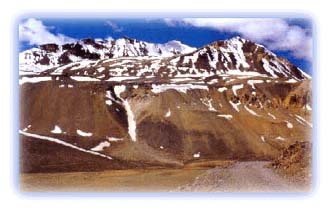 |
| The famous Baralacha Pass Credit: Discover India |
The magical land of Lahaul and Spiti consists of a network of soaring mountains and deep valleys. The altitude varies from over 6,500 m at high peaks to 2,740 m where the Chenab River makes its exit from the region.
The combined total geographical area of Lahaul and Spiti is 12,210 square kilometers. With a population of about 32,000, the population density is only 2 persons per sqare kilometer. Lahaul and Spiti probably have India's lowest population density, along with Zanskar, and habitation is concentrated at a few points along the main river valley.
 |
| Hanging glaciers near Kugti Credit: Karamjeet Singh |
Lahaul and Spiti are places where time stands still. Little has changed the landscape, which have been fashioned by the ice age. Ice and snow have sculpted the terrain, and next to the Karakoram region, Lahaul and Spiti possibly have the largest deposits of ice in the entire Indian Himalayas.
The timelessness has largely been due to the inaccessibility of the area. Lahaul and Spiti are completely surrounded by high mountain ranges. There are few routes in and out of the region. To the northwest lies the near impassable gorge of the Chandrabhaga River. The pass crossings are high and lead mainly into the other Trans Himalayan areas. Only three main passes connect Lahaul with the lower hills -- the Kugti leading to the Chamba Valley, the well-known Rohtang Pass leading to the Kulu Valley and the Hampta, a trekkers delight, also leading to the Kulu Valley.
All rights reserved