Kumaon himalayas
· Pithoragarh
· Dharchula
· Gori Valley
Other places of interest
· Nainital
Rivers
Flora and Fauna
· Tigers
· The Corbett Saga
People
· Kumaonese
· Bhotias
· Bhotias of Munsiari
· Bhotias of Dharchula
· Livelihood
· Recent changes in lifestyle
Economy
History

![]()
| General info The Kumaon Himalayas lie next to the Garhwal region and are situated on the Great Himalayan Range. Kumaon is often confused with the Garhwal region itself. Kumaon comprises the three hill districts of Nainital, Almorah and Pithoragarh. |
Garhwal and Kumaon compared to Switzerland. (Download Realplayer) |
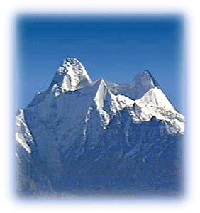 |
| View of Nanda Devi South, from Kumaon Credit: Karamjeet Singh |
It is bordered by Mahakali (or Kali or Kali Nadi) in the east towards Nepal and the districts of Pauri Garhwal and Chamoli to the west. Tibet lies to the north and the Terai to the south. The Mahakali River, running along its eastern boundary, forms the Indo-Nepal international border. Moving westwards, one comes across the Panchchuli Massif, the Gori Valley, and the Pindari and Sunderdungha valleys at the western end of Kumaon.
The Kali River and its valley are prominent in Kumaon. At one time, the Kali Valley was the standard trade route from India to Tibet, crossing over the Lipu Lekh pass. The Mahakali originates north of the main Himalayan range, carves its way through the Greater Himalayas and merges with the Ganga (Ganges) in the plains.
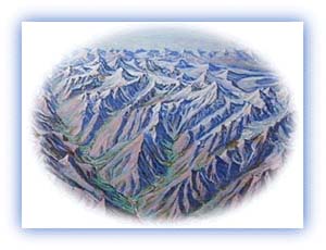 |
| Panchchuli Massif, from the Panorama by Serbjeet Singh Credit: Karamjeet Singh |
The Panchchuli Massif consists of five summits and forms the
barrier between the Darma and Gori valleys. According to the
legends, the five peaks form the chulhas, or cooking pots, in
which the Pandavas of the Indian epic Mahabharata cooked their
final meal on their way to heaven.
All rights reserved