Garhwal himalayas
General info
· Uttarakhand
· Eastern Garhwal
· Route to Badrinath
· Haridwar
· Rishikesh
· Devaparayag
· Srinagar
· Rudraprayag
· Chamoli
· Joshimath
· Mana and Niti
· Valley of Flowers
· Hemkund Sahib
· Route to Kedarnath
· Nanda Devi Sanctuary
· Nanda Devi
· Inner Sanctuary
· Outer Sanctuary
· Present-day Scenario
· Western Garhwal
Other Places of Interest
· Uttarkashi
People
· Jaunsaries
· Jadhs
· Marchas
· Bhotias
Religion
· Gods and Goddesses
Flora and Fauna
· Wildlife

![]()
|
Badrinath The holy town of Badrinath is located on the banks of the Alaknanda River about 24 km from its source. It lies in an open valley at an altitude of around 11,000 ft. According to Hindu mythology, this is the site where Lord Vishnu meditated for thousands of years, eating the Badri grass found here. Lord Badrinath is worshipped here, and it is the ultimate place of worship among the Vishnu worshippers of Hinduism. |
The Mandakini and Alaknanda contrast. (Download Realplayer) |
 |
| Badrinath Temple Credit: Raj Shirole |
is responsible for the great importance the shrine is given even today. He decreed Badrinath, along with the other dhams of Uttarakhand, to be a meeting place of heaven and earth and consequently a place of pilgrimage. According to legend, when the Shankaracharya visited the Mana Valley, he arrived at the Narada Kund at Badrinath and found fifty different images lying in its waters. These he rescued and placed in the shade of a mighty tree. In the course of time, a temple was built here. Over the centuries, Badrinath grew in fame and the number of pilgrims to the place increased. The present temple was built by the Raja of Tehri in the 15th century and the town continued to grow gradually in the intervening centuries. That was till the mid 1960s, when the motor road to Badrinath was completed. Pilgrim traffic has been expanding in a geometric progression ever since, and hundreds of thousands now pay obeisance at Badrinath every year.
 |
| Badrinath town with Neelkantha in the background Credit: Govt of India |
Badrinath is one of the "char dhams" (four holy shrines) in the Uttarakhand region. In addition to this, it is also considered to be among the four most holy places in India, the other three being Rameshwaram in the south, Dwarka in the west and Jagannath Puri in the east.
Badrinath is a growing township, thriving, lively, but somewhat dwarfed by the snow-capped peaks that tower above it. There is no dearth of small hotels, ashrams and dharamsalas. However, in recent years, the number of pilgrims visiting during the peak tourist season has increased so dramatically that accommodation too has started becoming a problem.
 |
| Neelkantha Peak near Badrinath Credit: Karamjeet Singh |
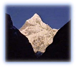
The Neelkantha (or Nilkanth) peak dominates the Badrinath Valley and towers high over it. Neelkantha literally means blue-necked, an allusion to the God Shiva's swallowing of the poison that was meant to destroy the world. The poison is believed to have remained in his throat, which was rendered blue afterwards. It is a majestic peak soaring to an altitude of 21,640 ft. From its ice-clad pinnacles, three great ridges sweep down, and the southern one terminates in the Alaknanda valley. Although seemingly very accessible, the Neelkantha remains an elusive peak for mountaineers, having been scaled only a handful times till now. From Badrinath town, one quickly gains a height of 3,500 m (10,500 ft) to the top of Neelkantha over a distance of only 9 kilometers as the crow flies.
A Different perspective of Badrinath. (Download Realplayer) |
The shrine closes in early November and most people come down to Joshimath. Road access is usually prohibited till May the next year. During winters, because of the altitude, Badrinath gets many meters of snow and the only people left in the region are detachments of the Indo-Tibetan Border Police and Military Intelligence.
All rights reserved