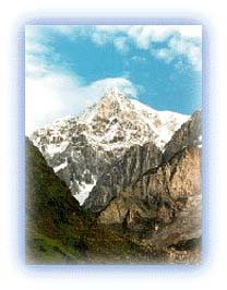
Garhwal himalayas
General info
· Uttarakhand
· Eastern Garhwal
· Route to Badrinath
· Haridwar
· Rishikesh
· Devaparayag
· Srinagar
· Rudraprayag
· Chamoli
· Joshimath
· Badrinath
· Mana and Niti
· Valley of Flowers
· Hemkund Sahib
· Nanda Devi Sanctuary
· Nanda Devi
· Inner Sanctuary
· Outer Sanctuary
· Present-day Scenario
· Western Garhwal
Other Places of Interest
· Uttarkashi
People
· Jaunsaries
· Jadhs
· Marchas
· Bhotias
Religion
· Gods and Goddesses
Flora and Fauna
· Wildlife

![]()
|
Route to Kedarnath - page 2 Also read the previous page Every year during the months of June-October this temple remains open to pilgrims who come here to offer their prayers. However, very few venture behind the temple courtyard. |
 |
| Kedar Dome, 6831m high. Credit: Raj Shirole |
The peaks of Kedarnath and Kedarnath Dome dominate the surroundings and look spectacular in the mornings. These two peaks are connected by a deep ridge that presents some superb climbing opportunities. Kedar Dome, 6,831 m high, presents a fair challenge and many climbers have made it to the top.
The Kedarnath peak is a more difficult proposition. Rising 6,940 m above sea level, the cornices of Kedarnath represent a tough challenge for those who attempt to climb it.
 |
| Bharatekuntha, 6578m high. Credit: Raj Shirole |
The Bharatekuntha peak, 6,578 m high, lies on the left of the Kedarnath peaks and is connected to the mountains by a long and dangerous avalanche-ridden ridge. It looks stunning and has several glacial flows, one of which is the Mandakini glacier running down its ridges.
An interesting day trek takes one behind the Kedarnath temple toward Bharatekuntha. Three kilometers away, in the valley formed by the Kedarnath massif, is Chorabhari Tal. This lake was renamed Gandhi Sarovar after Mahatma Gandhi's ashes were immersed in it.
All rights reserved