Garhwal himalayas
General info
· Uttarakhand
· Eastern Garhwal
· Western Garhwal
· Sacred Ganga
· Gangotri
· Gaumukh
· Route to Gangotri
· Dharali
· Harsil
· Wilson Saga
· Yamunotri
· Tons Valley
· Har-Ki-Dun Valley
· People
Other Places of Interest
· Uttarkashi
People
· Jaunsaries
· Jadhs
· Marchas
· Bhotias
Religion
· Gods and Goddesses
Flora and Fauna
· Wildlife

![]()
|
Towards Gangotri Crossing a bridge at Bhaironghati and leaving the Ganga far below as a black ribbon-like river, one finally approaches Gangotri. In the peak tourist season, one is more likely to be greeted by a kilometer long traffic jam and milling crowds than a picture of beauty, peace and grandeur. Hundreds of people flock to the Gangotri temple where the river is worshipped. |
 |
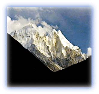
| Bhagirathi Peaks Credit: Karamjeet Singh |
The best alternative is to move on ahead and trek towards Gaumukh, 19 km away. This trek offers some exquisite views of the surrounding peaks. To the east of Gaumukh lies the Manda- Bhrigupanth group of peaks. Manda II is the highest peak among the three peaks of the Manda group and Bhrigupanth is 6,772 m high.
From Gangotri, a trail leads out towards the Kedar Tal. This is a lovely lake -- peaceful because the crowds are not attracted here. It serves as the base camp for climbing the 6,904 m Thalay Sagar peak.
Other major mountain peaks include the Bhagirathi series of peaks.
All rights reserved