Understanding our Environment
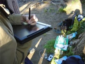
Sebastian Cathala Subjects: Geography, Sciences, Citizen Education Learners: ages 15 –17 years oldIn developing learners one teaches them responsibility and how to take steps to solve problems. The problem at Jean Moulin High was litter. Yet there were many dustbins on the property. Learners used a combination of Geographical Information System (GIS), and tablets and PDA devices armed with Global Positioning Satellite (GPS) capability to plot the incidence of litter. This data was superimposed on the map showing the location of dustbins. This provided the learners with the data they required to design a new anti-litter strategy by relocating the bins. Learners were engaged by this project because of the usefulness of a range of ICT tools and the fact that they were able to operate both in- and outside the classroom during the project. |
Themes: Content
|
|
Other innovation examples
